

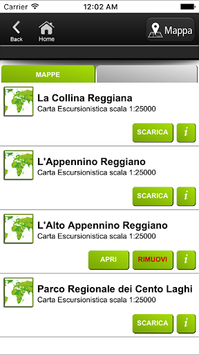
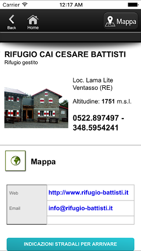
Features Sentieri Appennino
This App is dedicated to all mountain enthusiasts and hikers of the Tuscan-Emilian Apennines.It offers a series of maps and guides, downloadable for free, which integrate to form a continuous map of the territory.The territories currently covered include the area from Reggio Emilia and part of Piacenza, from the Apuan Alps to the Mantua areaOther areas are under development and will be published soonThe App allows you to see your position on the maps thanks to the GPS integrated into the smartphone and allows you to record the trace of the route taken.It also allows you to store personalized notes, to locate your points of interest on the map such as springs, botanical emergencies, mushroom farms.In the App, refuges, bivouacs and other information of interest to the hiker are listed and positioned, with the relevant information.It works off-line, i.e.
without the need for connection to the telephone network or internet.
This guarantees its full use even in the total absence of a signal and without any additional costs for telephone traffic.The App allows you to record tracks even with the screen off, so in this recording mode, and only in this recording mode, prolonged use of GPS in the background can drastically reduce battery life.
Secure & Private
Your data is protected with industry-leading security protocols.
24/7 Support
Our dedicated support team is always ready to help you.
Personalization
Customize the app to match your preferences and workflow.
See the Sentieri Appennino in Action

Get the App Today
Available for Android 8.0 and above